
 By James T. Hammond
Before it became known as Lake Robinson, named for a former chairman of the Greer Commission of Public Works, the region comprised the free-flowing South Tyger River, thousands of acres of farms, pastures and woodlands, and a naturally occurring pond known as the Devil Catcher.
I grew up here, on the farm of my grandparents, Claude and Clara Belle Barnette. Today, I live on a piece of that farm, preserved in woodlands and meadows that slope gently down to the shore of Barnette Cove. On what is now the Arrowhead subdivision, as a child I would follow Grandpa Claude through the cornfields as he plowed the weeds and grass from the furrows. Walking barefoot behind Grandpa and his mule, I would kick up clods of earth, and look for the arrowheads that even the youngest of us knew were a hidden legacy of people who lived on this land long before our people came here, just after the Revolutionary War.
Until the Cherokee tribes in the region sided with the British at the onset of the rebellion, the state of South Carolina had recognized this land as belonging to the Cherokee. The colonial government even actively discouraged the descendants of Europeans from settling on Cherokee land. The boundary ran roughly where the county line exists today between Greenville and Spartanburg counties, and continues to be memorialized by the name of Line Street in Greer.
Beside the entrance to the Stillwaters community on Groce Meadow Road, there is a small family cemetery that also memorializes the early non-native settlers in the region. William Moon died in 1833, and is buried there with other members of his family. I am a descendant of William Moon’s sister Rachael Moon Glenn. William Moon was born in Virginia and migrated to South Carolina when Cherokee land was seized by the state during punitive raids on their towns in the Blue Ridge foothills. After the Revolutionary War ended, the state began making grants of land to men who had participated in the militias that had fought against British forces.
For much of my life, I had associated the native American history of the region of my youth with the Cherokee. But a significant discovery in the front yard of my grandparents’ home changed that impression forever. In the early 1990s, the Barnette house was vacant for several years, and the grounds around the house largely undisturbed. Grass was sparse in the yard fronting on Groce Meadow Road. The rains had eroded the bare patches of soil, and created tiny pedestals earth holding up small stones. One day, as I walked across the yard, scanning the ground, I notice one stone that was markedly different from the natural stones of the surrounding soil. It was a distinctive triangular shape, its edges expertly crafted to form a point and cutting surface. It was a non-local type of stone known as Chert, widely used by the native peoples to make weapons and tools. It was an arrowhead unlike any I had ever seen in my years kicking up clods behind my Grandpa’s mule.
I immediately assumed it to be Cherokee in origin. But the truth was much more interesting. I took the arrowhead to Chester B. DePratter, Research Professor at the South Carolina Institute of Archaeology and Anthropology, University of South Carolina. This expert on prehistoric people of the Carolinas rolled the arrowhead over in his palm, felt its edges and shape, and declared it to be of truly ancient origin.
The arrowhead was, DePratter said, a Morrow Mountain type of point, possibly as old as 7,000 to 10,000 years old. It dated human habitation of the land of my youth to a time almost unimaginable.
In their book “Greer: From Cotton Town to Industrial Center,” authors Ray Belcher and Joada F. Hiatt provide a more fulsome explanation of what local farmers, souvenir hunters and archeologists have concluded about the early human habitation of the Lake Robinson environs. Belcher and Hiatt describe a plethora of artifacts that have been discovered over many generations that give a sense of how native people used the region. There is little to no evidence of permanent towns or villages. But there is plentiful evidence that those early humans used the South Tyger River basin as camping grounds, working areas to make stone tools and hunting grounds.
At the end of Cove Harbor Court in the Lanford Point subdivision is a cove fed by a small stream that flows during periods of plentiful rain. Before the lake was built, the stream flowed into a naturally occurring swampy pond known as the Devil Catcher.
As the lake was being built and the land cleared by bulldozers, artifact hunters had a rare chance to scour the landscape. Many arrowheads, spear points and stone tools were discovered in the newly uncovered soil. The types included more Morrow Mountain points, likely acquired from people in other regions of the Carolinas. But the artifacts also included arrowheads made from the quartz stone found in the vicinity of the South Tyger River. There was even a location where myriad chips of stone suggested a “stone-knapping” site, where weapons and tools were manufactured.
There is no satisfactory account of how the swamp acquired its name, but in my youth at least, it was a sinister place, home to myriad creatures, most real and some likely imagined. Stories about creatures that lurked in the dense vegetation abounded, and were often told to youngsters to scare them, or keep them from venturing into the abyss.
The Devil Catcher was the source of adventure for young boys of the 1950s and 1960s, and tragedy as well. One sad day in the community involved a neighbor boy in his teens, who was killed in a duck-hunting accident while beaching an old wooden boat at the Devil Catcher. It shook those of us who knew him, and became a cautionary tale about gun safety for many of us.
My Grandpa Claude loved to go fishing at the Devil Catcher and I often went with him. Interconnected wagon roads and trails traversed about a mile distant from Grandpa’s house (which still exists at the corner of Brooke Ann Court and Groce Meadow Road) to the swampy pond. Grandpa was not the only person who frequented the Devil Catcher. A neighbor, John Henery, could often be seen strolling down Grandpa’s driveway, a bamboo fishing pole over his shoulder, headed for the swamp. One day as I passed the hottest part of a summer day on the screened porch with Grandpa Claude, John Henry emerged from the maze of trails carrying by its tail a large snapping turtle. He paused to talk with Grandpa, and declared that dinner for his family that night would be turtle stew.
Some people often used the dense, swampy river and creek drainages to hide illegal activity from the law, mostly in the form of making bootleg whiskey. My Uncle Robert Huff loved to hunt squirrels on my Hammond grandparents’ farm, today known as Hammond Pointe. But in the 1940s and for a couple of decades afterward, the river zone was a great hiding place. Bootleggers would sneak onto the property under the cover of darkness, and set up their illegal liquor stills they cobbled together from steel drums and other found materials. Over the years, Uncle Robert discovered more than one such illicit still on my Grandmother Pauline Hammond’s property. He would dutifully call the sheriff’s office, and deputies would be sent out with guns and axes to destroy the stills and collect evidence. One of my Grandpa Claude’s brothers was a deputy sheriff who sometimes assisted in the enforcement actions, and somehow my Grandpa always seem to have a gallon or two of the clear, powerful and untaxed booze in his pantry.
The most spectacular action against the bootleggers came one night when I was in high school. Sometime during the night, my brother Mike and I were awakened by a tremendous explosion some distance from the house. The next morning the telephone party line lit up with the story of the blast. Bootleggers had built a distilling operation in the very edge of the Devil Catcher. Sheriff’s deputies and revenue agents had been alerted to its existence and were watching as the bootleggers arrived after dark to continue their work. As the lawmen surprised the outlaws, the offenders fled into the Devil Catcher swamp, only to be chased down in the boggy water. The still was one of the largest in the region. Lawmen who usually chopped holes in barrels with axes saw that method as unrealistic. So they set off several sticks of dynamite in the middle of the distillery. The blast that awakened me and my brother flung parts of steel barrels and other debris high into the trees. We visited the site the next day, and saw the debris hanging from the tree limbs. A couple of barrels survived the blast intact, still containing the mixture of water and corn mash fermenting to become alcohol. I approached one of the barrels, peaked over the side, and saw a possum floating in the mash, apparently attracted by the smell of the fermentation and killed when he plunged into the deadly mixture. I continue to wonder to this day if, left uninterrupted, the bootleggers would have simply removed the dead possum and run the fermented liquid through their distiller coils anyway.
The Devil Catcher was the source of many stories that survive today, including the fabled existence of a race of large black cats, panthers, that were rumored to have lived in the swamp. Sometimes people believed they heard the frightening cries of the beast at night. It was a ghost, firmly embedded in local lore, but never seen, killed or captured. A warden on the lake fervently believes he spotted one of the cats in the headlights of his car near his home on Lake Robinson. It is difficult to believe that such a race of panthers could exist without one being killed on the roads by a car, or captured on the ubiquitous game cameras in the wilds today. But it is equally difficult to dislodge the belief that the beasts still roam the lake’s environs.
The shores of the lake have sprouted hundreds of homes since the basin filled in the late 1980s. But a few remnants of the farms that lined the South Tyger River survive. The broad grassy hillside beside the William Few Bridge that crosses the lake is a remnant of the land settled by my third great-grandfather, William Few, in about 1790. He lived on that hill until 1856, when he died at age 85. He is buried in a family cemetery, with other members of his clan. And some of his descendants still own that hillside.
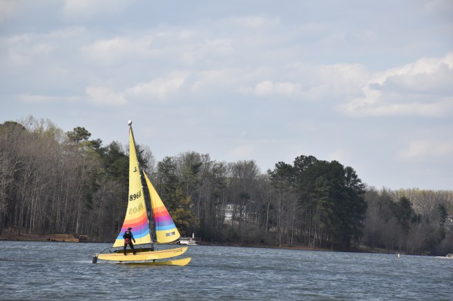
Today, William Few’s view from his hilltop log cabin would be far different, comprising a broad expanse of water in a 950-acre lake with 27 miles of shoreline and 6.5 billion gallons of water capacity. The lake was conceived in the 1970s because the City of Greer’s first reservoir, Lake Cunningham, had become one-third filled with silt from erosion on upstream farmland and sand-mining in the South Tyger River. Today’s conservation measures enforced by the Greer Commission of Public Works aim to prevent a similar destruction of capacity in Lake Robinson.
Lake Robinson has brought a new vitality to this neck of the woods. Many of the new residents know little about the land’s history. But many, upon learning that I was born and grew up here, and have deep family roots in the area, are intensely curious. The Greer Commission of Public Works continues to seek to preserve some of the pastoral character of the lake, by protecting the lakeshore from development. These policies not only preserve the pleasing natural beauty of the space, but also protect the water quality. It is of utmost importance for the people of the Lake Robinson community to support the CPW in its efforts. This does not mean prohibiting people from using and enjoying the lake, but simply enforcing common sense policies to keep the lake safe, protect the environment, and pass it along for future generations to enjoy.
